Officially named places of First Nations origin in NSW, Australia
Recently I was curious about the origin of my street name and my search online led me to the NSW Geographical Names Board, a government body responsible for the management and administration of geographic and place names within the state of New South Wales, Australia.
So not quite what I was looking for but I still found this to be a fascinating data set, which is helpfully available as a CSV file with all record information from the Geographical Name Register that the Board maintains.
The data set includes an ABORIGINAL NAME field and so I thought it would be interesting to visualise how many places in NSW are of First Nations origin vs not.
How I did it
I used the ever fantastic Folium package to visualise this data.
But before I could use Folium I needed a GeoJSON file so what I did was write a Python script to take this CSV file and turn it in to a GeoJSON file. You can find the script, which is executed daily (so the data is fresh and of use to anyone else out there), and GeoJSON file in this repo.
Data accuracy
I want to flag that I can't verify as to how accurate this data is.
The aforementioned ABORIGINAL NAME field is blank for many rows/places that, according to the MEANING or ORIGIN fields, are of First Nations origin. I contacted the Board and they told me that the ABORIGINAL NAME field was "...a recent edition to the Geographical Names Register (it was only added 2 years ago).".
So what I've done is also included any places that, according to the MEANING or ORIGIN field, are of First Nations origin.
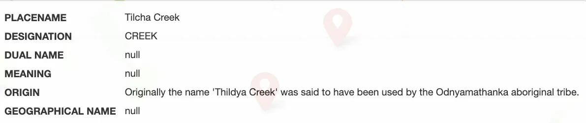
Again, I can't speak to the accuracy of these fields - you can see my doubt when presented with descriptions like this:
However I've included these places anyway.
I've also only included places that have been officially 'assigned' by the Board.
You can read more about the different place designations here.
Visualising the data
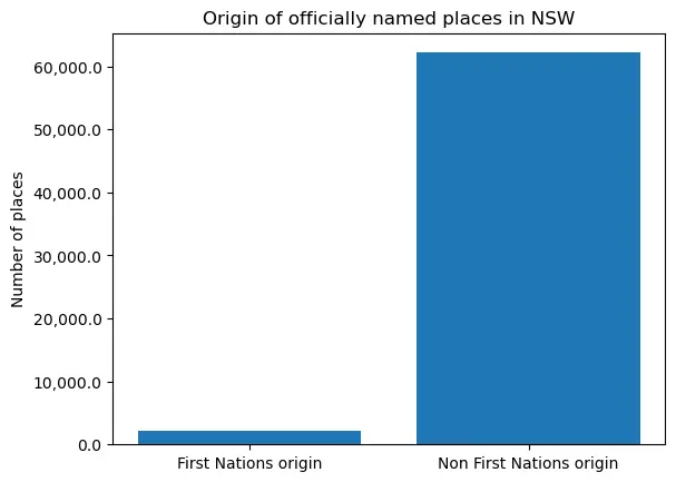
Originally I wanted to plot all the named places on a map however the Folium map created was so large that it crashed my browser. I want to note that this is because of the large number of places that are not of First Nations origin.
Creating a Folium map with places of First Nations origin was of no issue, size-wise:
While I couldn't use Folium to show the vast number of named places that are not of First Nations origin you can see it in this column chart:
If you want to see the Jupyter Notebook I used for this you can check it out in this Github repo.
Comments !